Dispatch
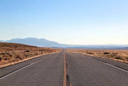
Beautiful and Deserted Roads in the US
Road trips can bring to mind everything from bumper-to-bumper traffic and roaring semitrucks to peaceful stretches of countryside. Yet the popularity of U.S. National Scenic Byways suggests that many travelers would rather spend their time enjoying beautiful landscapes without dealing with heavy traffic. In fact, some of the country's most impressive roads are also among its least crowded.
Freya Lennox
Rider
Desk note
Full dispatch and transfer tips sit below.
Line
Blue Line Walk
Road trips can bring to mind everything from bumper-to-bumper traffic and roaring semitrucks to peaceful stretches of countryside. Yet the popularity of U.S. National Scenic Byways suggests that many travelers would rather spend their time enjoying beautiful landscapes without dealing with heavy traffic. In fact, some of the country's most impressive roads are also among its least crowded.
Whether you are looking for an adventurous and potentially challenging drive through the mountains of Alaska or a peaceful journey across the sunlit deserts of Utah, Nevada, and Arizona, these quiet routes offer long stretches of solitude and striking scenery. One of them even passes through an area inhabited by polar bears.
Here are 10 scenic and relatively traffic-free roads worth exploring in the United States.
Beartooth Highway (Montana and Wyoming)
U.S. Route 212 stretches for 68 miles through the mountains of Montana and Wyoming. The highway winds across Beartooth Pass, which rises to 10,947 feet above sea level, before reaching the entrance to Yellowstone National Park.
The high elevation is responsible for much of the spectacular scenery, but it also means the highway remains inaccessible for more than half the year because of snow. Beartooth Pass generally opens around Memorial Day and remains accessible until mid-October. Even during summer, however, sudden storms can temporarily close the road or create dangerous whiteout conditions.
The Montana section of Route 212 features numerous tight switchbacks and elevation changes averaging roughly 250 feet per mile. Around the road's highest point are 20 mountain peaks, along with scenic alpine forests and valleys.
With steep drop-offs and sharp bends throughout the route, drivers need to remain alert and confident behind the wheel. The challenging conditions may be one of the reasons this remarkable highway sees relatively little traffic.
U.S. Route 50 (Nevada and Utah)
U.S. Route 50 stretches across the country, and its section through Nevada earned the famous nickname “the Loneliest Road in America” from Life magazine in 1986. The publication originally intended the description negatively, but Nevada's tourism officials quickly recognized the promotional value of the label.
When Geotab released a ranking of some of the quietest roads in the United States in 2015, it selected Nevada's Route 360 rather than Route 50. Route 50 did, however, earn the distinction of being the quietest road in neighboring Utah.
The reputation of being America's loneliest road probably comes from the lack of settlements along its path through the Great Basin. Travelers encounter broad desert valleys and more than a dozen mountain passes.
In Utah, the route continues through canyons and mountain passes, with long stretches separating one service station from the next. Covering 408 miles in Nevada and another 334 miles in Utah, this two-state road trip requires considerable preparation and endurance.
Highway 71 (Nebraska)
Nebraska Highway 71 travels from north to south across the entire state. Located in the sparsely settled western part of Nebraska, the highway passes through only a small number of communities. The largest is Scottsbluff, which has a population of about 15,000.
Agriculture dominates this part of the Midwest, so farmland makes up much of the landscape. However, the scenery is more varied than the region's flat reputation might suggest. Roughly in the middle of the highway's 170-mile length, the Wildcat Hills introduce distinctive sandstone formations to the landscape.
Kimball, located just north of the Colorado border, lies close to Nebraska's highest point. The surrounding area also has an unusual connection to Cold War history, as it was once known for its missile silos.
Travelers continuing north into South Dakota may encounter more traffic, particularly once they approach the popular Black Hills region.
U.S. Route 160 (Arizona)
U.S. Route 160 begins in Missouri and extends for 1,465 miles through Kansas, Colorado, and New Mexico before ending near Tuba City, Arizona.
The Arizona section covers 256 miles and is the least traveled major roadway in the state. It serves as one of the principal routes through the Navajo Nation, a 27,000-square-mile Native American territory that remains governed by the Navajo people.
Despite its enormous size, the territory has a population of only around 350,000. As a result, travelers can experience long stretches of nearly empty desert, interrupted mainly by the highway and unusual rock formations.
One notable attraction is Elephant's Feet, a pair of eroded remnants of Jurassic Entrada Sandstone that look remarkably like an elephant's feet and toes. Along the route, visitors can also encounter additional sandstone formations and an ancient Pueblo cliff settlement.
Near the highway's end in Tuba City, travelers can also find dinosaur tracks, although their authenticity has been the subject of considerable debate.
Dalton Highway (Alaska)
The Dalton Highway extends 414 miles from the outskirts of Fairbanks, Alaska, northward to Deadhorse, an oil town on the Arctic Ocean.
The highway takes its name from James Dalton, an Alaskan engineer who oversaw the construction of an important radar installation during the Cold War.
With the possibility of snowstorms even in August, hundreds of miles between fuel stations, and less than half of its surface paved, the Dalton Highway has earned a reputation as one of the country's most hazardous roads. Many of the vehicles traveling along it are large trucks transporting supplies to Alaska's oil fields.
For adventurous travelers, however, the spectacular surroundings and possibility of spotting a polar bear can make the journey worthwhile.
The road passes beneath snow-covered mountain peaks, crosses the famous Yukon River and travels through the boreal forests that characterize much of Alaska. It also crosses the Arctic Circle.
Because conditions on the Dalton Highway can be extremely demanding, motorists should bring a CB radio, spare tires, emergency equipment and sufficient survival supplies.
State Route 139 (California)
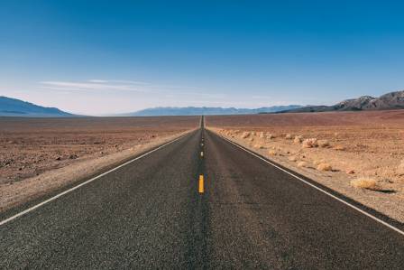
California State Route 139 covers 143 miles across the northern part of the state. It begins in Susanville and continues north until reaching the Oregon border, where it becomes Oregon State Route 39.
Northern California's inland regions are among the least densely populated parts of the state, which helps keep traffic relatively light on this road.
Route 139 passes through the 1.6-million-acre Modoc National Forest, an area known for its wide variety of ecosystems. Much of the sometimes stark scenery was shaped by volcanic activity millions of years ago.
The highway was originally envisioned as a connection between Oregon and Reno, Nevada, while also improving access to nearby national parks, forests and monuments.
Construction progressed slowly, and some portions remained dirt or gravel even after development plans were established. Despite its importance within California's highway network, the road remains primarily a two-lane route.
State Route 812 (New York)
New York State Route 812 begins in the Black River Valley near the foothills of the Adirondack Mountains and travels approximately 80 miles to the U.S.-Canada border crossing at Ogdensburg.
Upstate New York is well known for its natural scenery, which offers a dramatic contrast to the dense urban environment of New York City. Route 812 delivers a classic rural experience, passing small hamlets along with numerous lakes and rivers.
Travelers carrying passports can cross into Canada via the Ogdensburg-Prescott International Bridge. Once in Ontario, they can continue along King's Highway 16, which runs from Prescott toward Ottawa.
The quieter Canadian portion does not last very long, however. King's Highway 16 merges with the busier Highway 416 not far from the Saint Lawrence, meaning traffic conditions soon become less peaceful.
Colonial Parkway (Virginia)
Virginia's Colonial Parkway is officially designated State Route 90003 and extends for 23 miles through a rural part of the state.
As a scenic byway, it does attract visitors, but commercial trucks are prohibited. Cars also travel at considerably lower speeds than on major highways, with posted limits generally ranging from 35 to 45 mph.
There are relatively few intersections because cross traffic passes over the parkway using bridges.
The name “Parkway” suits this road well. Tall trees line both sides, creating a beautiful shaded corridor. Several historic communities are located along the route, while its brick bridges complement the area's colonial character.
Drivers will also find historical markers and designated areas where they can stop, leave their vehicles and explore the surroundings.
Because commercial traffic is absent and local commuters have other routes available, most vehicles on the Colonial Parkway are tourists. As a result, traffic tends to remain light.
U.S. Route 2 (New Hampshire)
U.S. Route 2 is made up of two separate east-west sections across the northern United States. The western portion stretches from Washington to Michigan, where the Great Lakes interrupt the route. The eastern section begins in upstate New York and crosses New England.
In New Hampshire, the road has a 35-mile section that Geotab identified as the quietest road in the state.
Rural New Hampshire generally has relatively little traffic, and this entire section of Route 2 lies within Coös County, the northernmost county in the state.
The road runs alongside White Mountain National Forest and passes near Mount Washington, the highest mountain in the Northeast.
Along the journey, drivers will encounter a collection of small towns and hamlets, as well as several attractions. One unusual stop is a Santa Claus-themed amusement park.
State Route 32 (Pennsylvania)
Pennsylvania State Route 32 is commonly called River Road because much of its 41-mile route follows the Delaware River along the New Jersey border.
The highway also has an important connection to American Revolutionary War history. George Washington and his troops famously crossed the Delaware River in this region, and a historical marker along the route commemorates the event.
The combination of dense foliage, historic small towns and riverside scenery makes Route 32 appealing for travelers seeking a relaxed drive. Both residents and visitors use the road for leisurely trips.
Traffic is generally light, although the highway passes directly through the main streets of several communities. Rather than detracting from the experience, those towns are an important part of the character that makes River Road distinctive.
Nearby stops
 STOP
· en
Getting an Unmanned Rover Under Control
Nessa Vale
 STOP
· en
The Key Reasons to Purchase a Watermill Painting
Eloise
 STOP
· en
The Powerful Impact of Area Rug Shades on Home Environments
Maxwell Thomas Stone
 STOP
· en
Chronology and Culinary Myths of the Cream Puff
Daniel Brooks
 STOP
· en
Yellowstone Supervolcano
Cassian Everleigh
 STOP
· en
Meet the Ocean’s Mysterious Giant Manta Rays
Cassiel Wynn